


Test
rgergerg
read more
[mapps] : [mapping applications]
Whether you work with extensive geodata or just a small set of places or objects, we help you make that information visible and tangible on maps. We add the geo component to your data – from simple tables and addresses to rich datasets – and turn it into intuitive, interactive map experiences that tell a clear story and immediately make your information easier to understand.
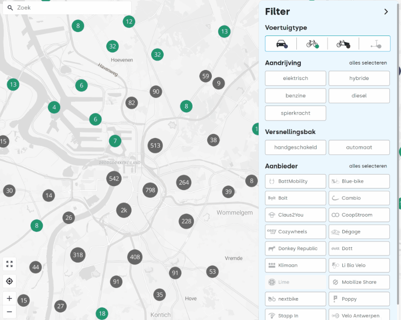
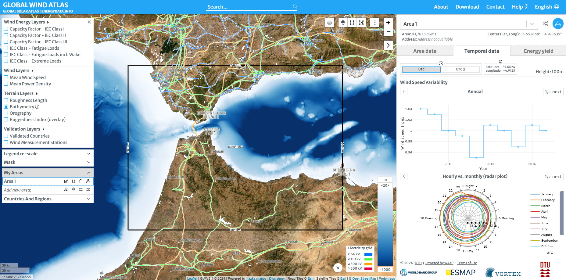
Way To Go: map makes shared mobility visible to everyone
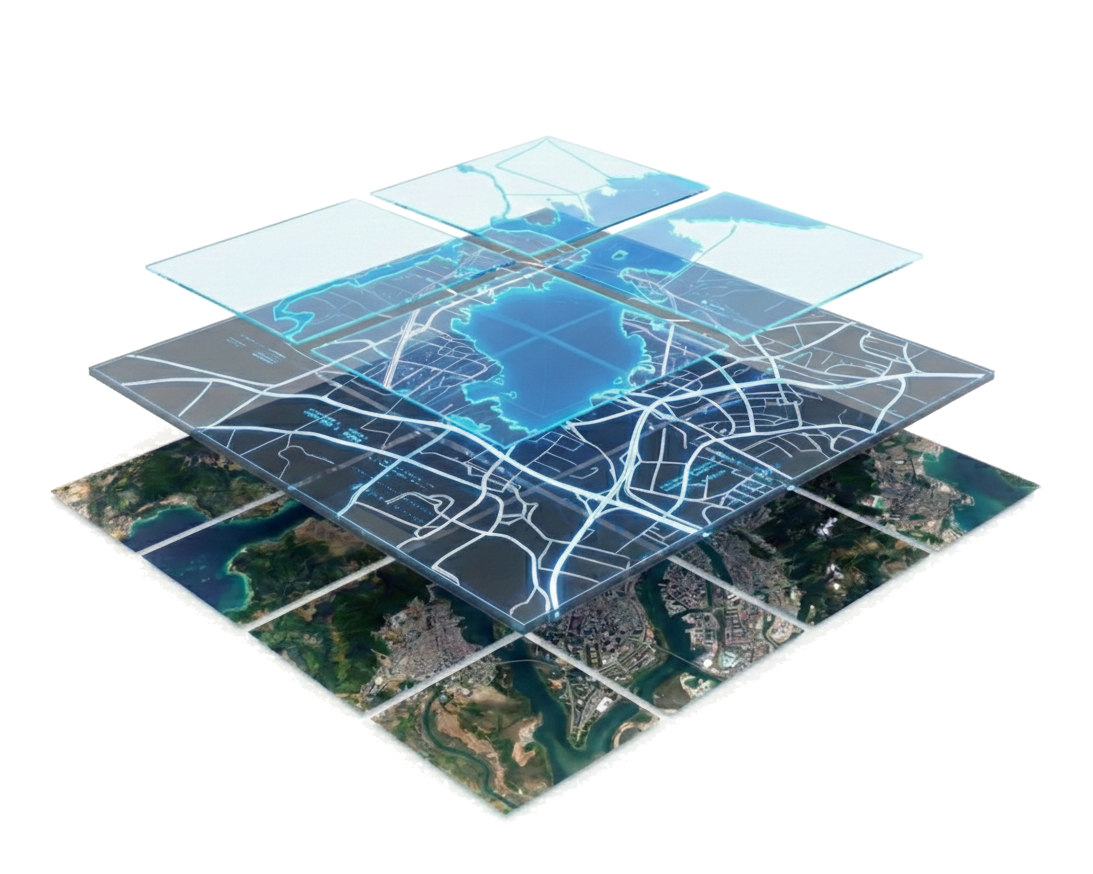
Many organisations still rely on traditional GIS servers and on-premise solutions: powerful, but often rigid, expensive and hard to scale. Nazka helps you take the next step towards a modern geodata stack, combining deep GIS expertise with cloud architectures and open standards, ready for advanced analytics and AI while you retain full control and ownership.
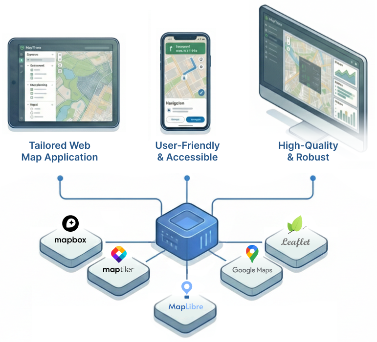
A first prototype in tools like Google Earth or Felt is quickly made, but you soon run into its limits. That is when you need professional maps that perform reliably in daily operations, not just in demos. We design, build and operate secure solutions for you, so you can focus on your core business. By using open-source technology, cloud services and automation, we keep the total cost of ownership low, leaving space to grow with your ambitions.

Fully custom map applications, no templates. Strong focus on UX, accessibility and clear cartographic design.

Robust and cloud-native map platforms that are easy to run, easy to scale and cost-efficient over the long term.

An active partner in social and public sector projects, committed to increase understanding, participation and real-word impact.

In-house development team specialised in modern, scalable, cloud-native geodata infrastructure and data pipelines.
"We can focus on the data and not have to worry about the user interface. We also have been developing more professional practices thanks to the collaboration."
Picture taken at MAP Mercator museum in Sint-Niklaas, Belgium


