19 april 2021
DTU Wind Energy and nazka mapps introduce a series of important improvements in version 3.1 of the Global Wind Atlas. New exciting layers have been added for visualisation and download, while the overall design has slightly changed with more focus going to the management of customized areas. We migrated the mapping system to the newest version of our Mapframe, allowing users to adapt the visualisation of the map layers to the local situation. The responsive design has significantly improved as well, optimizing the experience for users on tablets and mobile devices.
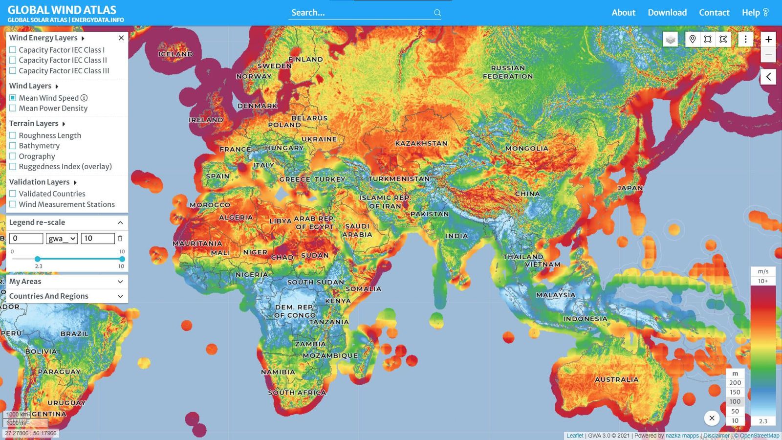
Figure 1: Screenshot of the Global Wind Atlas 3.1
When exploring potential wind energy sites, users can assess wind resources in predefined areas (Countries And Regions section), or use their own sites (My Areas section) that can be uploaded to or drawn directly on the map. The management of the My Areas section has significantly improved in version 3.1, with the possibility to upload, download and save custom areas per area or in bulk. In the Countries And Regions section, more validated countries have been added, as well as the World Bank Group's analysis of offshore wind technical potential for emerging markets. In both modes (predefined or custom areas), you can download (clipped) GIS data for all layers, different wind resource datasets, validation reports and high quality printed maps..
It is important for us that the vast amount of data that lie behind the Global Wind Atlas brings as much value to the user as possible. For that it is necessary to create intuitive interaction between the user and approximately 2 TB of data available for display in the atlas. Working with Nazka Mapps has enabled our data to come alive in the hands of the users via the realization of browser based customized wind and map analysis tools. -- Jake Badger, Head of Section, DTU Wind Energy
An increased interactivity of the raster layers in version 3.1 allow users to better pinpoint the most promising sites for yielding wind energy. Thanks to the migration to a tiff-tile based raster visualisation, the colour scale for each layer can be customized, as well as the legend range: changing the minimum and maximum value of the legend dynamically modifies the colours of the raster layer, highlighting the most promising sites in the user's specific area of interest. We also included the option to have an accurate numerical data readout in the legend and near the mouse cursor, and embedded a ruler to measure distances. Last but not least, new layers have been added, including a new Bathymetry layer; a spectacular layer which allows visitors to access seabed bathymetry when exploring offshore wind projects.

Figure 2: The new Bathymetry layer supports the exploration of offshore wind development
The Global Wind Atlas is a free, web-based application developed to help policymakers and investors identify potential high-wind areas for wind power generation virtually anywhere in the world, and perform preliminary calculations. The tool facilitates online queries and provides freely downloadable datasets based on the latest input data and modelling methodologies. The GWA website has been continuously reimagined from the bottom up since 2017 by Nazka Mapps, under contract to DTU Wind Energy, and funded by Energy Sector Management Assistance Program (ESMAP), a multi-donor trust fund administered by The World Bank and supported by 13 official bilateral donors.


